Wednesday, August 10, 2011

August 8 - Denali NP Day 2

We started off hiking from our campsite, up past the Visitor Center, then decided to take the Mt. Healy Overlook Trail.  The mountain summit is at 5,200 feet, but we didn't plan on making it that far due to the snow and cold at that elevation.  Here's a picture showing the mountain and where the trail goes up.  The arrow on the far right shows the very top, taken a day later when it was cloudy up there.


The climb up was pretty steep, so we made quite a few stops along the way to take in the views.


And to snack on a few wild blueberries.


Once at the end of the official trail, we could look down on the entrance area to the park and the whole area around it.


Roxane decided she had enough mountain climbing for the day, but Matt wanted to keep going a bit further.  So Greg left his pack with Roxane and brought up the rear. 


Then Matt decided he had enough of Mt. Healy.  Greg was relieved....


Let's not forget Roxane....she's the little black spot huddled up out of the wind behind some rocks down there.


Well, maybe you can spot her if we zoom in.  By the time Matt and Greg got back, Roxane was chilly and all bundled back up in her coat, hat and gloves.


 So back down the mountain we went, which was almost as bad as going up, just different parts of the body hurt.


Back to the first picture of this post, the first arrow on the left is the overlook, and the middle arrow is the peak that Matt and Greg hiked to.  According to the GPS, our camp is at about 1,800 feet, Roxane went up to about 3,700 feet, and Matt and Greg went up to about 4,200 feet.  For being relatively out of shape, we did pretty good, but certainly felt it when the day was done.

August 7 - Denali NP Day 1

On Sunday, we took our time packing up, hoping for the rain to stop.  It finally did, so we headed north to Denali at about 11 am.  Along the way, as we crossed over the mountain pass just south of Denali, we saw what happens to rain at the higher elevations this time of year.


Another 20 miles or so and a few thousand feet lower, we arrived.


We found ourselves a nice corner spot at the Riley Creek Campground.  Not much of a view here other than the woods around us.


Our first stop in the park was the Visitors Center, where we watched a short movie, looked over all the displays, and tried to figure out how we're going to spend our next 5 days here. 


We had enough time to take a drive 15 miles out to Savage Creek, the end of the paved part of the Park Road and the furthest you can drive on the road (unless you have a reservation at the Teklenika Campground, which is about 29 miles out).  There are some great views along this part of the road.


No view of Mt. McKinley today - it's somewhere behind these mountains and clouds.


We did also see a moose far away from the road, so far the picture didn't really turn out, a bunny rabbit, and a photogenic beaver hanging out at the pond.


Tomorrow we'll do some hiking.

Tuesday, August 9, 2011

August 6 - The Trip to the Top of Mt. McKinley

It's Saturday morning and we're ready for our "flightseeing" trip to the top of Mt. McKinley.  Considering the rainy weather we've had and that is forecast, and the fact that we're sure not going to climb it, this may be our only chance to see the mountain.  We can see blue sky to the south and the clouds are moving to the north, so looks like we'll have a pretty good flight.

We booked the 11:00 flight on a 10-seat plane with Talkeetna Aero Services.  Matt drew the copilot seat.  Roxane and I are right behind the pilot and him.


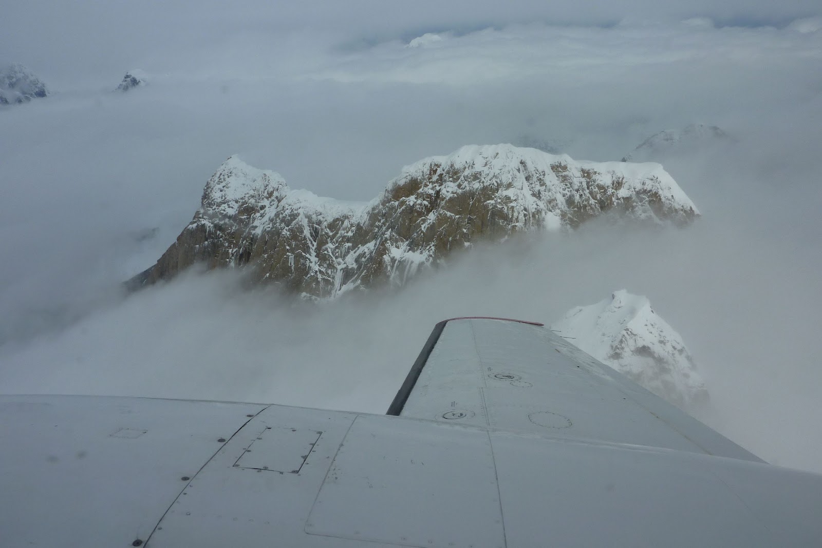
Flying towards the Alaska Range, it's pretty cloudy and we wonder if we're going to see much of anything except for the highest mountains peaking up through the clouds.


But then we can see that on the north side, everything opens up.  We get our first look at McKinley off the left wing.


..and the right wing.


The pilot took us back and forth along the north side of the 20,320 mountain, at about 18,000 feet.


We all have our oxygen masks on at this altitude.  Climbers don't use oxygen on McKinley, but they spend weeks on the mountain getting used to the thin air.


The top 1,000 or 2,000 feet are under the weather that McKinley creates for itself.


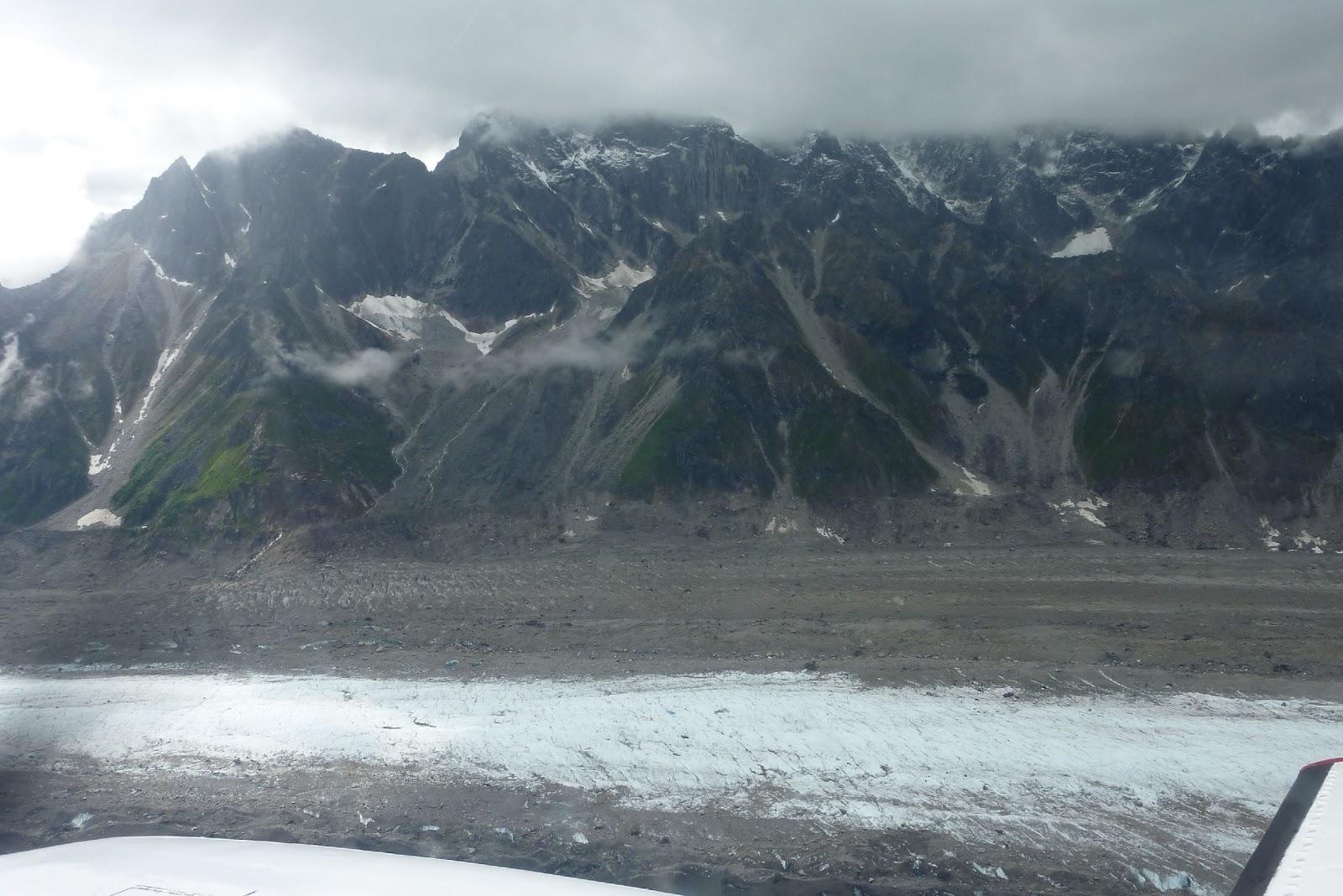
We flew over the Ruth Glacier and a couple of the others that flow off Mt. McKinley.  The view was spectacular!


Flying back around the south side, the pilot pointed out this favorite of rock climbers, the Moose's Tooth, poking up above the lower level of clouds.


Then we descended below the lower clouds to fly along the huge glaciers.


This blue pool of water really stood out.


About 20 minutes later we were coming in for a landing.


And thanking our pilot Dave, a retired 30 year commercial pilot, for a great flight.


We spent a while bumming around Talkeetna, another tourist town full of gift shops and restaurants, one of which served up some huge cinnamon rolls for our afternoon snack.

Then the rains came and we headed back to our camp at Trappers Creek, which is a typical, 2 or 3 store town in the middle of nowhere.  No Walmart, but they did have their own version of a mega-store:


Sunday, August 7, 2011

August 5 - Matt Comes to Alaska!

Friday is finally here and we're off to pick Matt up at the airport.  We drove up to Anchorage in the rain, but as we got closer to the city the blue sky and sunshine came, making it a great day.  We dropped the trailer at one of the local Sam's Clubs so we could fill up with fuel, food, and propane.  We got to the airport just as Matt got off the plane, so great timing there.

We decided to make the one hour drive back down the the Portage Glacier so Matt could see some of the sights we've been seeing for the past few days.


And a sunnier view of the Portage Glacier.


Then we headed back to Anchorage to pick up the trailer and drive north about 120 miles to Talkeetna. 

Driving along the Turnagain Arm/Bay of the Cook Inlet, we get to see the "bore tide", a wave caused by the tidal action in the inlet.  Today all we could see was a small wave (look just above the guard rail), but they say these waves get up to 10 feet high and surfers ride them.  Pretty cool.


Tomorrow is our big flightseeing trip to the top of Mt. McKinley, or as the natives named it, Denali, which is Koyukon Athabaskan for "The High One".